For 12 days in October, a 34-foot aluminum boat motored back and forth across Commencement Bay at about 8 knots.
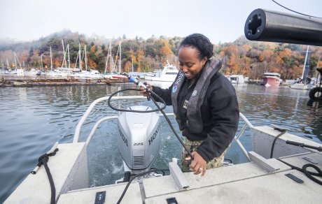 While the route pattern had all the variety of mowing a lawn, the work taking place onboard belied this monotony. Using sonar technology capable of identifying a tire 100 feet below the water surface, a three-member National Oceanic and Atmospheric Administration (NOAA) crew collected data for charting 1.5 square nautical miles of the waterways approaching the Port of Tacoma and the Tyee Marina.
Lt. j.g. Michelle Levano was the officer in charge of the hydrographic survey crew that included Lt. j.g. Nicholas Azzopardi and Navy Lt. Shunika Johnson. They spent about eight hours per day on the water, slowly putting together a picture worth much more than a thousand words.
After processing the data, the critical updates that may pose a danger to navigation are applied immediately to the charts. Meanwhile, the non-critical findings are submitted through a report to NOAA’s Office of Coast Survey and later updated. It is important information to the success, safety and vitality of the waterway.
 “An accurate understanding of our waterways is a valuable exercise because vessels have grown substantially in size and depth over recent decades,” said Lou Paulsen, Port of Tacoma’s director of strategic operations projects and risk management. “All stakeholders who use those waterways need to have accurate information.”
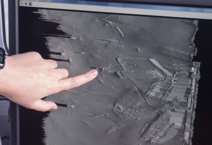
To perform the hydrographic survey, a sonar device is affixed to the bottom of the boat. On board, monitors relay data and images to the crew. The data is later corrected to account for tides.
If the crew finds an uncharted navigational hazard, it is reported immediately so details are circulated to those who need it within 72 hours. No such surprises were found in Commencement Bay, Levano said.
To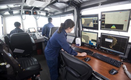 nya Kauhi, the port’s GIS programs manager, says the Port of Tacoma independently surveys the area approximately every two to three years to minimize any surprises. “It’s important to be proactive,” she said.
There will be changes to future charts as a result of the survey. Many pilings listed on charts are no longer in existence, Levano said. The crew also found 15 wrecks on the seafloor near Tyee Marina and classified 12 previously known wrecks as no longer significant.
The hydrographic survey is also important to the health of local salmon habitats. While ships need deep water, salmon thrive in shallow water. And, around the port, deep and shallow water are closely juxtaposed, Paulsen said. Survey data helps determine if changes need to be made.